I took two very different trips over the past two weeks, both of which involved the Danube River, its changing history, and two very different river/city interactions. First, I went to Regensburg, which still has (esp for Bavaria) a great deal of its medieval architecture and city plan intact, including a bridge from the twelfth century. The next weekend, I went to Vienna, where I presented for the first time on my newest research project (including some early medieval poems on the source of the Danube) and also met with friends and colleagues who are part of a research group that is doing a long-term environmental history of the Danube, and took a walk along the course of the former Danube.
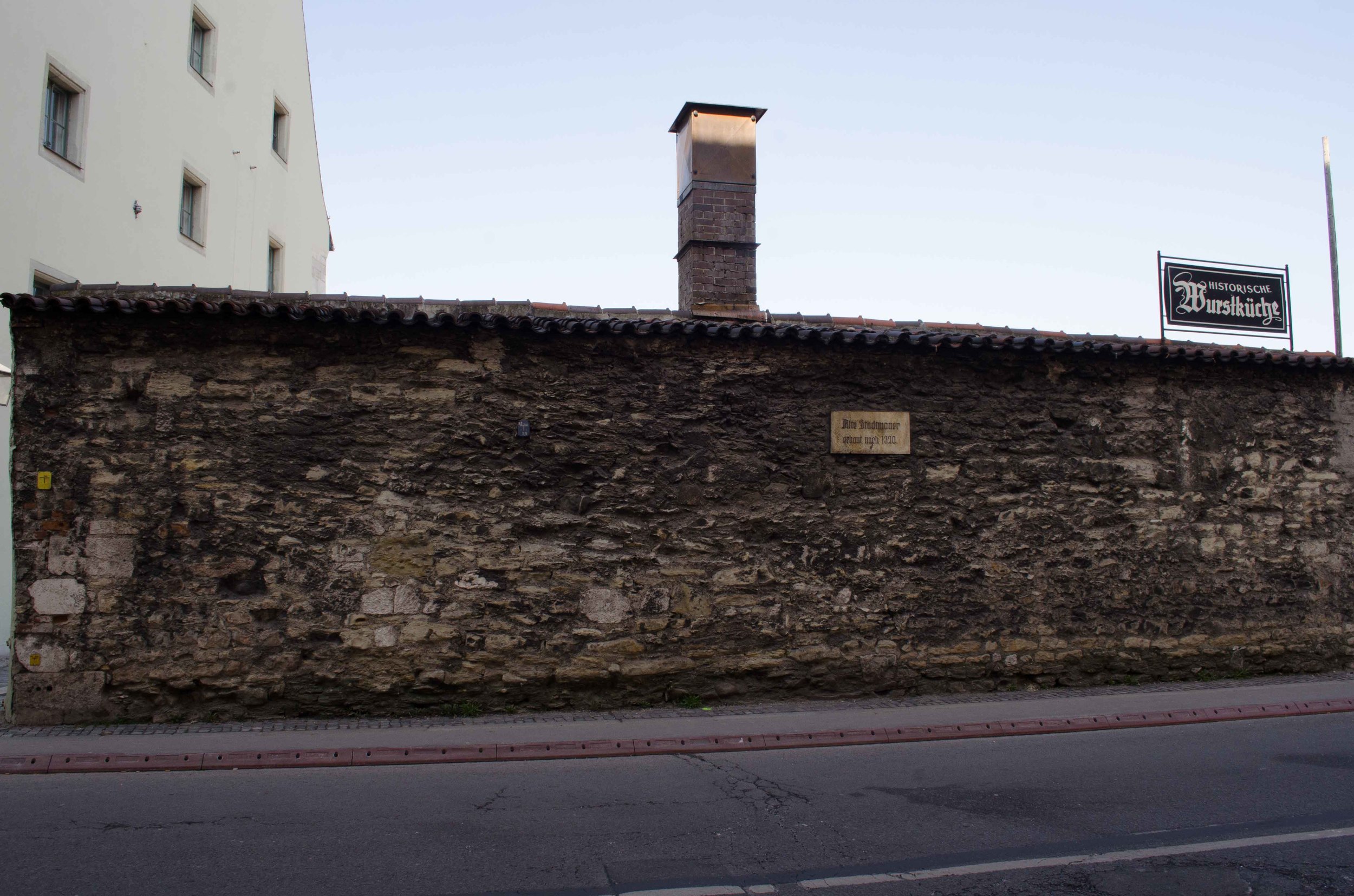
During the early and high middle Ages, Regensburg was an important economic and administrative city in Bavaria, and had a great deal of wealth and prestige (in part because of its strategic Danubian location). This only increased when the Steinerne Brücke (Stone bridge) was built across the Danube, connecting the city to Eastern land traffic. It’s a massive bridge, and remains in use up to today, though now it is pedestrian only. This was as you might guess a massive building effort, and the project required not only huge amounts of materials, but also an extensive labor force, who all, of course, had to eat! Enter the Regensburg Wurstkuchl, that allegedly opened all the way back in the 1100s to serve food to the bridge workers. It eventually took over a small storage shed built along the medieval wall alongside the quay to continue to serve dockworkers and bridge traffic. Today it still serves beechwood smoked wursts and kraut (that’s all they have!) and you can sit out alongside the bridge and the Danube enjoying a very medieval view and experience.
(note that the back of the wurst hut is the vestige of the old medieval town wall!)
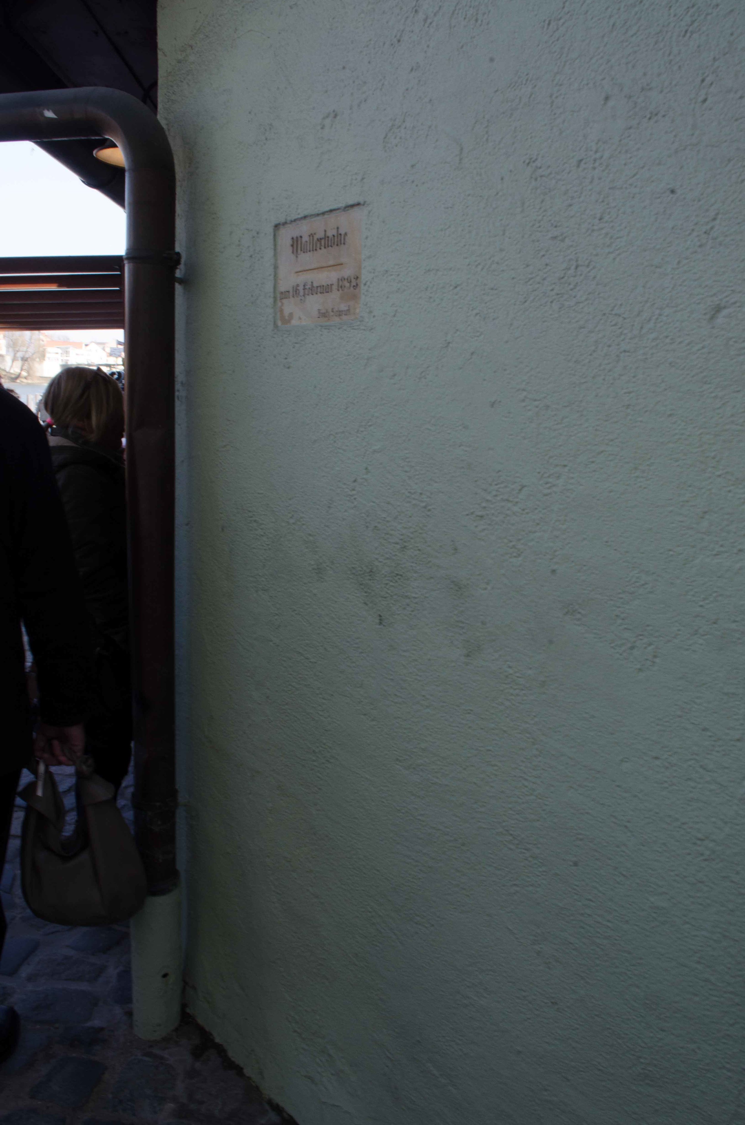
In addition to this remarkable piece of medieval engineering, another aspect of life along the changing Danube really stuck out to me: the presence of historical and modern flood markers on buildings noting the high water points of memorable floods.
Here are examples, both from the walls of the Wurstkuchl, <--one from 1893
and one --> from 2011.
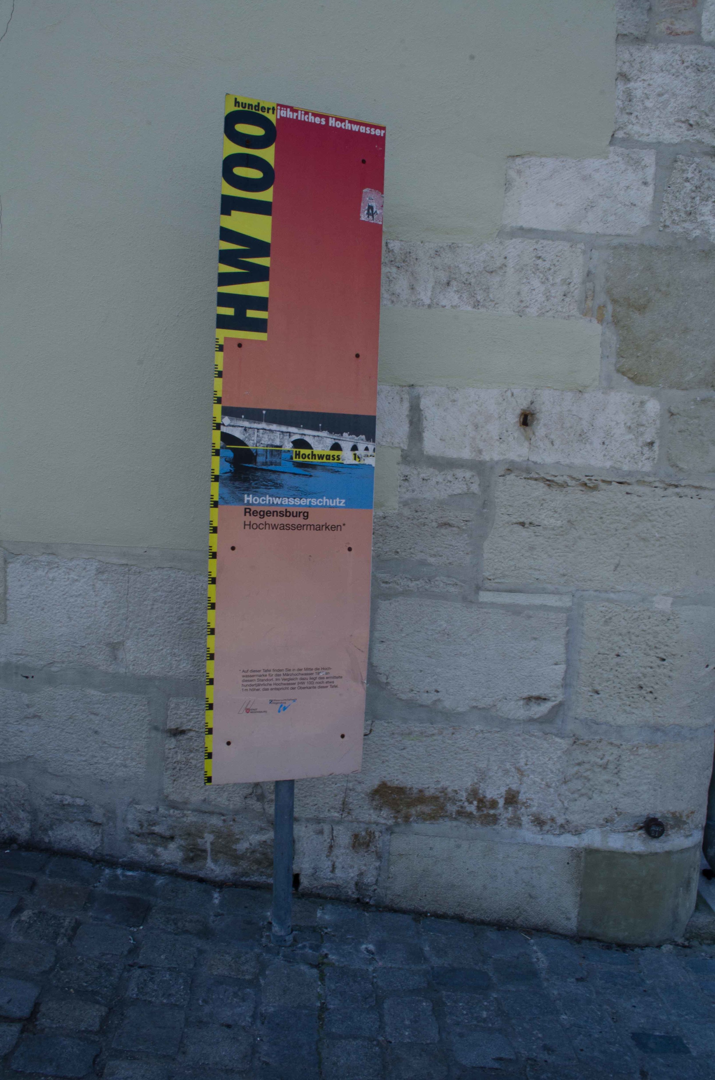
There was also an interesting temporary set of displays around the city showing the height at individual locations of the flood from 1994 and then, at the top of the sign, the estimated height of where a “hundred year flood” would come up to in that same location.
I was quite intrigued by this combination of public history, environmental education, and risk awareness, and when I talked to a colleague who has worked on medieval and early modern river flooding, he pointed out part of what this campaign may be doing—it turns out that Regensburg used to have many many more markers on buildings of historic flood levels, but that today, many owners are removing them, because they hurt the resale value! (Of course, taking the sign off doesn’t change the flood risk at all, and perhaps even increases risk due to setting aside awareness of floods….but perceptions….)
So, this was my first peek at the Danube; my second experience exactly one week later was a very different way of thinking about change over time and the erasure of the markers of the river’s past on a city. Through my role with the journal Water History, I have been lucky to get to work with a special issue on the Danube, featuring the work of an Austrian team working on the environmental history of the Danube. It’s a groundbreaking project and an exciting interdisciplinary group of historians and scientists. One of the things that they have demonstrated is the tremendous amount of change that has taken place over the past 1000 years both to the river itself (which until recent times was a very active and fluctuating river) and to the relationship of the city and the river. Saturday, I went with one of the project members (Gertrud Haidvogl) on a walk in the middle of downtown Vienna to see this first-hand. She took a reconstructed map of the river from the early 1700s (part of the broader project) and laid it over a satellite image of the modern city—and we headed out.
Here was once the main arm of the Danube and an area of fishing houses:
Here is the Donaukanal, which in the 17th and 18th centuries was not only part of the main branch of the Danube, but also probably at least twice as wide with islands in it.
And finally, the modern “Danube,” set aside from the modern town through a massive engineering project that also made it straight and predictable.
It is a fascinating story, and one that should be soon available for you to learn more about--I will post links once the journal is available for readers!! It was a remarkable thing to see the complete scale of the transformation, to understand more tangibly how completely the river and its history have slipped away from the city, and to see the magnitude of the deliberate changes that have been made to the Danube.
Put together, these two experiences of very different stretches of the Danube showed both how connected the river still is to some of its past identities and how much people have deliberately altered their relationship to this river, and even tried at different points to both record and forget the fluctuations of this massive river.


